Valencia Flash Floods
A week after the DANA catastrophe, we show the extent of flooding in the province of Valencia through maps highlighting the locations of the main affected municipalities.
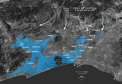
One week after the flash floods (DANA) that devastated the province of Valencia, RTVE needed to show the real scale of the disaster: not just how many municipalities were affected, but where they were and how they related to one another across the region.
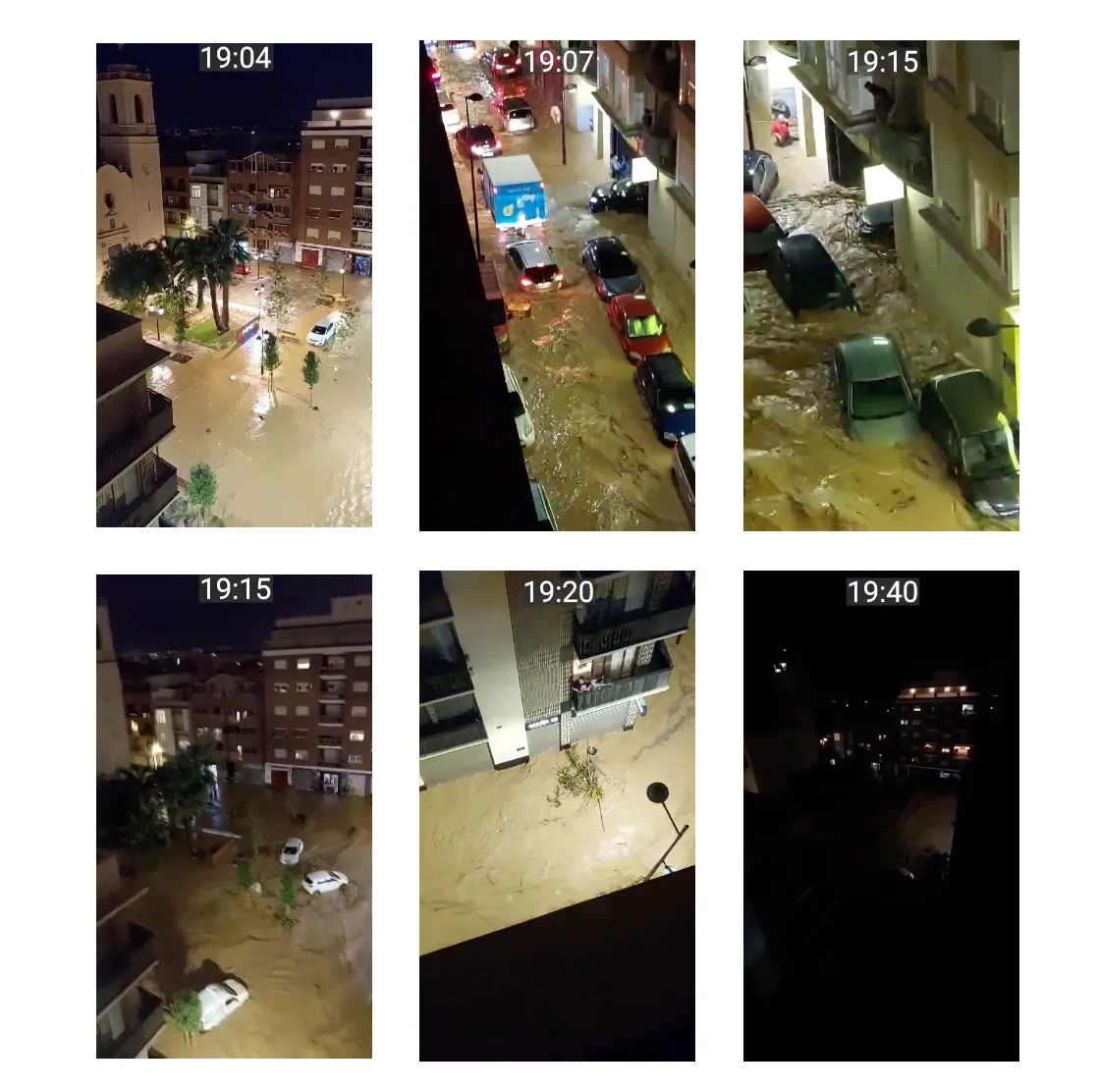
Representing the real extent of the flooding through maps, so the reader could grasp at a glance which areas had been hit hardest.
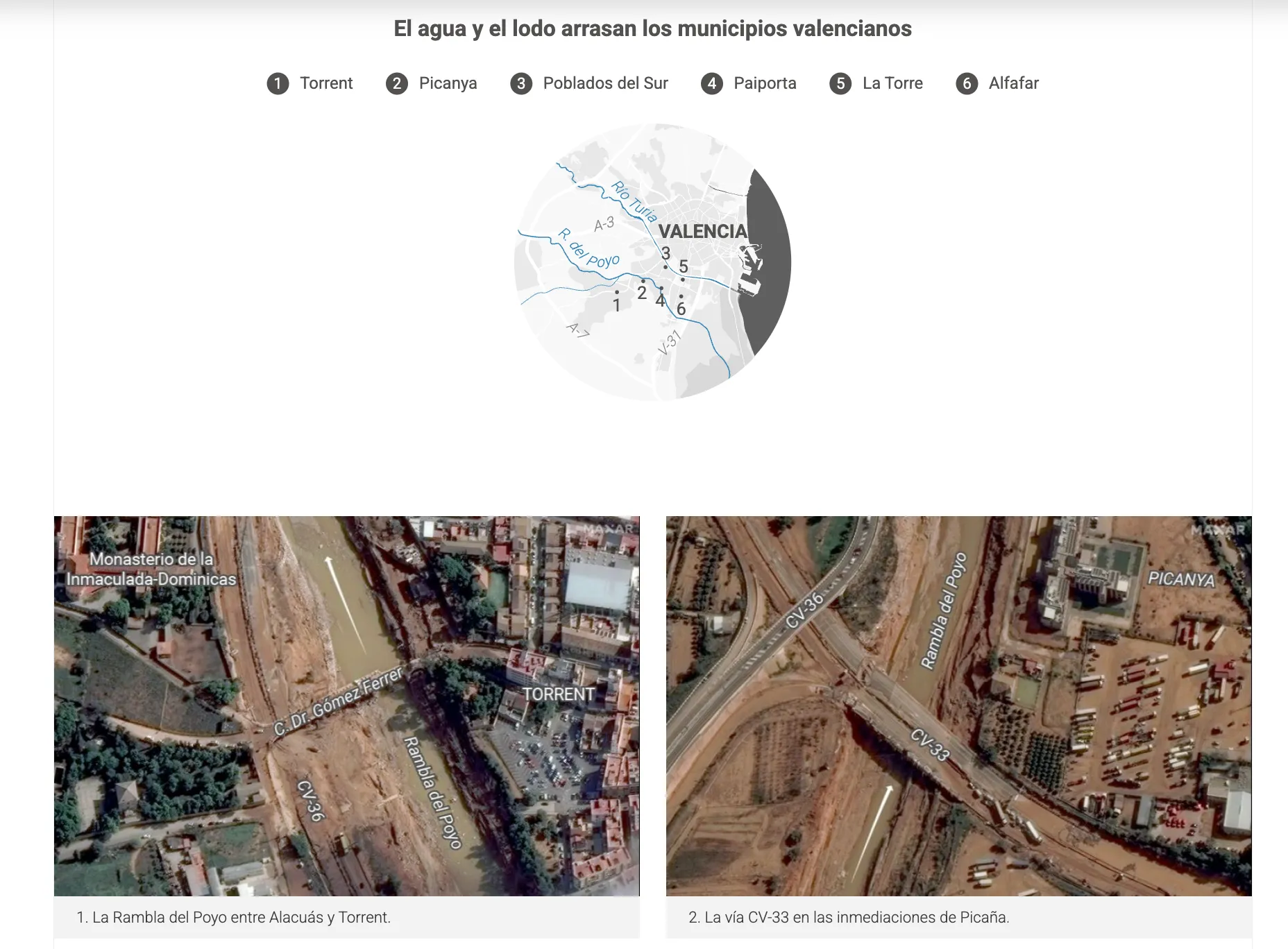
I worked with geographic data to build the base map and designed the symbology for each affected municipality, prioritizing informational clarity given how sensitive and urgent the topic was.
Share