How to build earthquake-proof buildings?
Using the Venezuela earthquake in the La Guaira area as a case study, we use Copernicus-based maps, satellite imagery and infographics to explain why two buildings can respond so differently to the same earthquake, and what construction and prevention challenges remain in Spain.
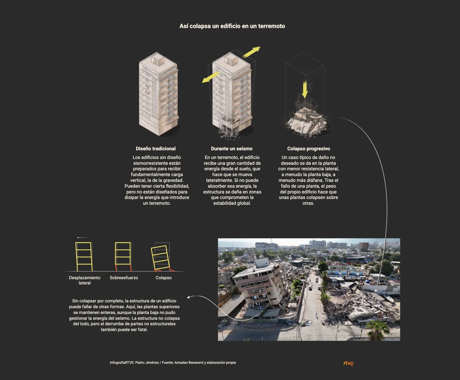
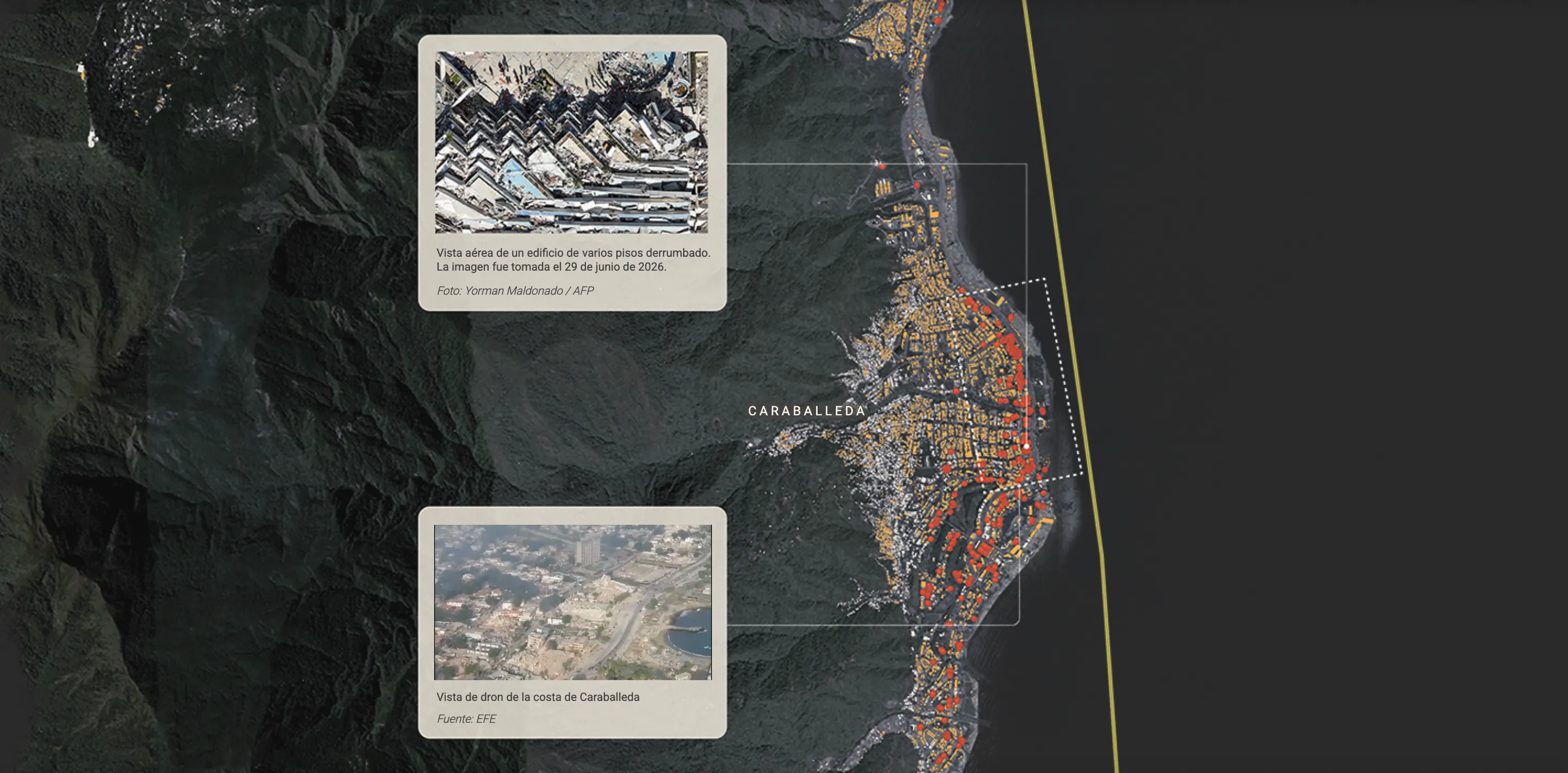
Using the Venezuela earthquake in the La Guaira area as a reference, this piece for RTVE combines maps built from Copernicus data, satellite imagery and infographics explaining how buildings respond to an earthquake, why some collapse while others withstand it, and which construction solutions help reduce the damage.
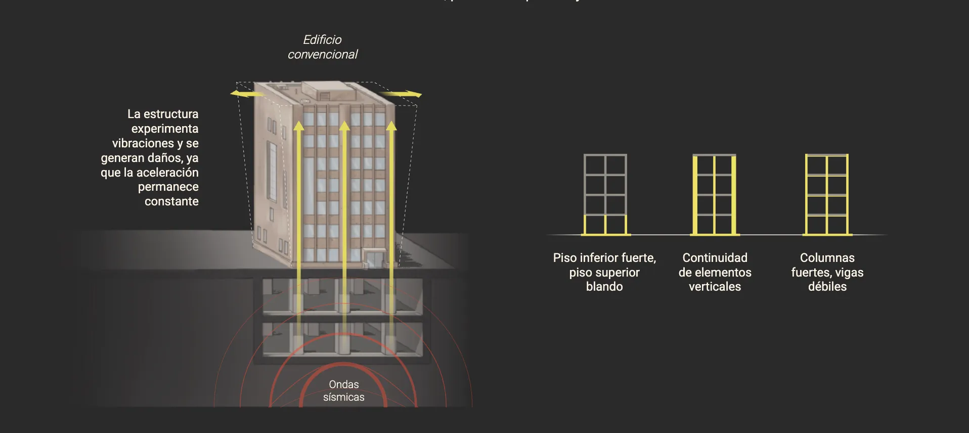
How is it that two buildings standing side by side can respond so differently to the same earthquake?
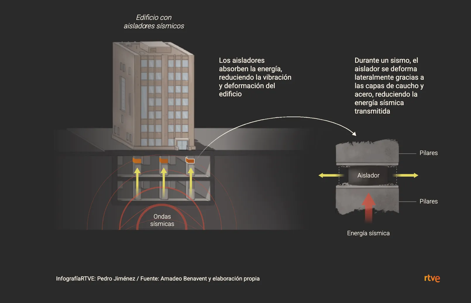
We explore what this disaster teaches us about seismic engineering and the challenges Spain still faces in construction and prevention, trying to make a complex issue easier to understand through data visualization.
Share